DaveInDenver
Rising Sun Ham Guru
To visualize what I meant by following the real divide vs walking it vs what you can do mechanically or motorized.
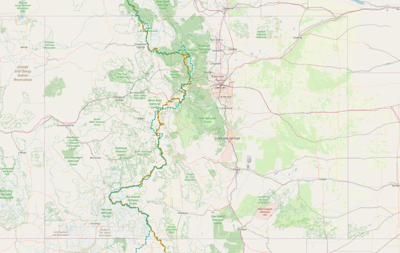
This is the actual CDT that you can backpack or horsepack shown against the hydrological divide.

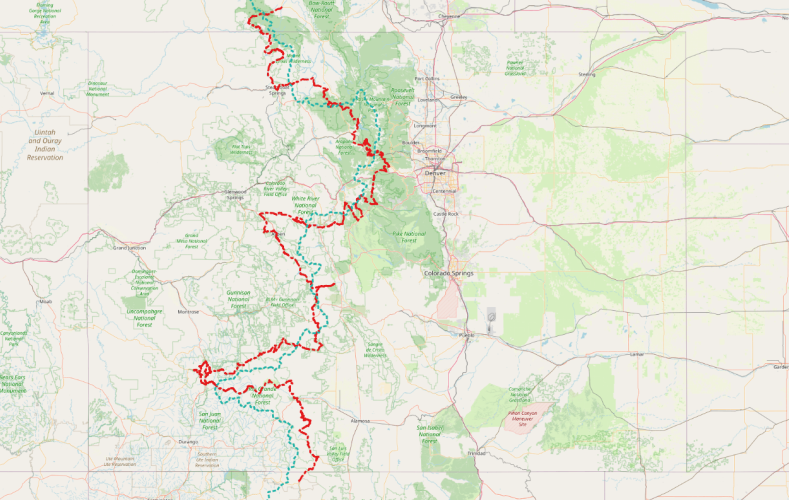
This is my working second revision motorized route. I did not try sticking to easy roads but only ones that should be full size legal. Some of this is too hard IMO to drive as a through-route and what of the middle sections I did was mixed 4x4 and MTB. This is more suited to a close knit group with more like 10 days dedicated. There's bound to be doubling back and route finding.

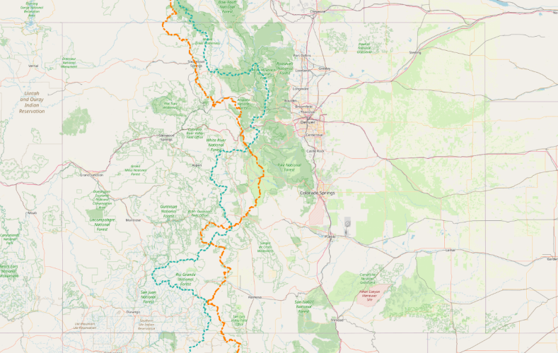
This is the route that the Great Divide MTB race follows. They have a bias for gravel (e.g. not technical mountain biking) and ease of supply. I'd suggest this could be a good route as a club run but it's just not well aligned to the Continental Divide. It would get the state line to state line part off pavement for a larger group in a few days.

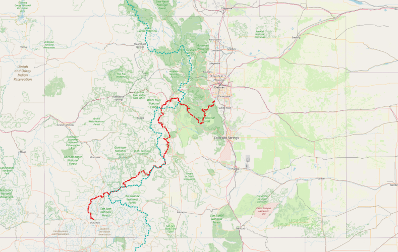
To get a bit more context, this is the open to MTB Colorado Trail vs hydrological divide. I leveraged some of this since I had first hand experience on how it avoided Wilderness but as a route it's not suitable for 4WD OHV planning purposes. Also doesn't assist with the reservation around Four Corners.

This is the actual CDT that you can backpack or horsepack shown against the hydrological divide.

This is my working second revision motorized route. I did not try sticking to easy roads but only ones that should be full size legal. Some of this is too hard IMO to drive as a through-route and what of the middle sections I did was mixed 4x4 and MTB. This is more suited to a close knit group with more like 10 days dedicated. There's bound to be doubling back and route finding.

This is the route that the Great Divide MTB race follows. They have a bias for gravel (e.g. not technical mountain biking) and ease of supply. I'd suggest this could be a good route as a club run but it's just not well aligned to the Continental Divide. It would get the state line to state line part off pavement for a larger group in a few days.

To get a bit more context, this is the open to MTB Colorado Trail vs hydrological divide. I leveraged some of this since I had first hand experience on how it avoided Wilderness but as a route it's not suitable for 4WD OHV planning purposes. Also doesn't assist with the reservation around Four Corners.

Last edited:
