thinking of leaving Gaia.. OnX?

nakman

Rising Sun Member
Staff member
Joined
Aug 23, 2005
Messages
15,720
Location
north side
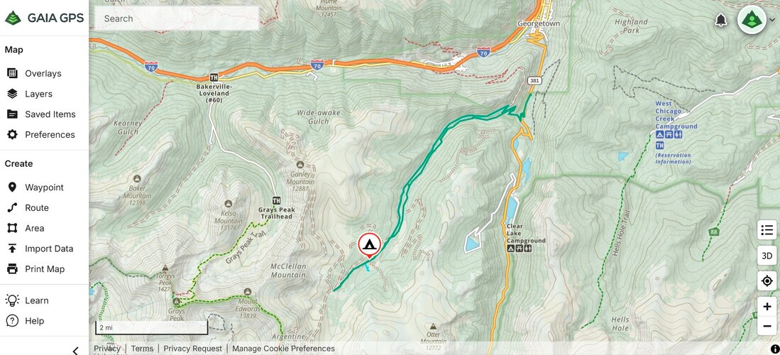
Just came back from a trip where I forgot to start my Gaia tracking while we still had cell service, and referred to one of the other guys Onx app. I was blown away by how much clearer the maps were with Onx. I could zoom right in our camp site and see some old logs that were there, while Gaia could not zoom in as far and just showed a blurry clearing.
Yeah. I have had similar experiences while backpacking... trading phones with a OnX guy and he looks at my Gaia. that's why I made the switch.

And I've been forcing myself to use OnX pretty much exclusively, it's a little big of a drag losing all waypoints from Gaia but not a big deal as I already know where most of them are, or at least the ones that matter.

One feature it lacks though, prehaps I just don't get it yet is being able to export a route as a .kml for Google Earth, or a .gpx track that I can email. It's like they want you to just share it with other users within the OnX software... again maybe I just don't know how to do this yet, but I thought one of the cool tricks with Gaia was being able to create something then just share it with anyone, even if they don't have the software.
 

On the RX

Rising Sun Member
Joined
Nov 19, 2016
Messages
2,400
Location
Superior
A features i am looking for is being able to track a route, drop pins with notes or photos, and share with anyone I choose whether they have that specific program or not. I would like for us as a club to have the ability to accurately mark and add a photo of areas that need attention, then share that with a group that are going out to do volunteer work as well as with the FS to show them precise locations of issues or areas that were repaired.
 

nakman

Rising Sun Member
Staff member
Joined
Aug 23, 2005
Messages
15,720
Location
north side
Ok that got me trying to figure this out again.. I found the Export feature. So here's the link OnX provides when I want to "share" a route:


But when I get into my saved items, I see that I can export the .gpx and .kml files, just like with Gaia. I'm curious how these look to you, like without an OnX account can you see that route? Or does it make you create an account? And then can you open up the attached?
 

Attachments

MountainGoat

Club Treasurer
Staff member
Cruise Moab Committee
Joined
Jul 4, 2008
Messages
3,556
Location
Evergreen, CO
Ok that got me trying to figure this out again.. I found the Export feature. So here's the link OnX provides when I want to "share" a route:


But when I get into my saved items, I see that I can export the .gpx and .kml files, just like with Gaia. I'm curious how these look to you, like without an OnX account can you see that route? Or does it make you create an account? And then can you open up the attached?
I couldn't open the link without signing up.

The attachment opened up fine for me in Gaia:

Argentine Track.jpg
 

Johnny Utah

Rising Sun Member
Joined
Mar 6, 2015
Messages
1,637
Location
Arvada
Well I just purchased a year of OnX with the Labor Day coupon and now have both.

I don’t really love Gaia, nor have I taken the time to learn how to use it properly. But it does help out sometimes (as long as you download the map beforehand) but I just keep it because it auto renews…I know, terrible reason.

I’ve been wanting to try OnX offroad for a while but haven’t wanted to pay for two subscriptions.

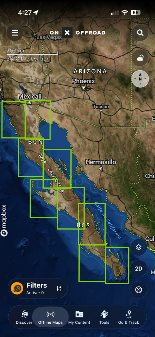
I just got the app today and downloaded some maps for offline use, and I’m hoping it’s a little more user friendly than Gaia. We’ll see.

IMG_7176.png

I’ll get to try it out this weekend on the Dino Run. And then we’ll see how it does down in Baja. That’s really the only reason I got it. OnX advertised additional support for Mexico so I had to give it a shot.

Couldn’t pass up the smokin deal! Thanks @Inukshuk !
 
Last edited:

Inukshuk

Rising Sun Member
Joined
Aug 24, 2005
Messages
8,695
Location
Denver, CO
That what made me ask the question
Yup. Thanks because I had unsuccessfully looked for this thread before creating the new one I wanted the info here.

@Johnny Utah OnX is getting more and more features. It loads faster than Gaia. Seems every time I switch between apps when Gaia is running I get the splash screen which is a delay and never gets me back exactly to where I need.
 

Johnny Utah

Rising Sun Member
Joined
Mar 6, 2015
Messages
1,637
Location
Arvada
Yeah I think my problem with Gaia is that I am not great at using it to its full potential, AND I think it’s kinda clunky.
 

MarkEva

Rising Sun Member
Joined
May 15, 2024
Messages
156
I've used it a lot and have 200 saved items. I think it works pretty well. I especially like leaving the active fire overlay on all the time so I see new fires. I see two downsides: one, it's $60 a year because It part of the Outside package and they're not that good anymore. Two, they have no information on what a "road" is like. Some of them are relatively easily driven even if not maintained, and some are washed out boulder fields.
 

nakman

Rising Sun Member
Staff member
Joined
Aug 23, 2005
Messages
15,720
Location
north side
I've pretty much adapted to OnX. My only real beef is that there's no real time altitude, speed, etc. like you can get with Gaia. But all of that is eclipsed by the better mapping clarity, I continue to run into situations where Gaia thinks there's no road here, and OnX, says there's totally a road here. Have had a few fun experiences this year with that.
 

Romer

Moderator
Staff member
Joined
Aug 22, 2005
Messages
10,791
Location
Centennial, Colorado
I've pretty much adapted to OnX. My only real beef is that there's no real time altitude, speed, etc. like you can get with Gaia. But all of that is eclipsed by the better mapping clarity, I continue to run into situations where Gaia thinks there's no road here, and OnX, says there's totally a road here. Have had a few fun experiences this year with that.
Thanks Tim and also Daniel for the code

I signed up and will give it a try. I will figure out how to input all my gpx files and see if all my trails show

If I make the changes on my computer via the logged in web page, does it sync with the app running on Android or do I have to load each one?
 

Romer

Moderator
Staff member
Joined
Aug 22, 2005
Messages
10,791
Location
Centennial, Colorado
Ok I have been playing with it the last few hours. Been kind of a pain editing stuff after importing that doesnt show in Gaia like lots of way points, but maybe getting the hang of it. Maybe I will do Slaughterhouse next week with Gaia and Onx both displayed on my Android Head unit and see how that goes
 

Inukshuk

Rising Sun Member
Joined
Aug 24, 2005
Messages
8,695
Location
Denver, CO
Thanks Tim and also Daniel for the code

I signed up and will give it a try. I will figure out how to input all my gpx files and see if all my trails show

If I make the changes on my computer via the logged in web page, does it sync with the app running on Android or do I have to load each one?
It will sync.
 

nakman

Rising Sun Member
Staff member
Joined
Aug 23, 2005
Messages
15,720
Location
north side
It will sync.
Not only that but if you're using Carplay, you can put a waypoint on your phone and see it pop up on the screen in real time. I realize that's not all that amazing but I have found this feature to be really sweet... like when someone else is driving I can manipulate the map, put up little flags that say turn left here, etc. so the driver sees what's coming.
 

Romer

Moderator
Staff member
Joined
Aug 22, 2005
Messages
10,791
Location
Centennial, Colorado
I have it running on both my Phone and my Android Head Unit. I will have to play with the split screen on my Head unit vs one on the head unit and the other on my phone

Slaughterhouse
1789400933294.png

Fins and things. I did go into the trails on Onx and delete a lot of the waypoints so its cleaner. I havent done that on Gaia

I do like altitude and speed on Gaia, but I can get that elsewhere

I have both subscriptions paid through next Moab so I will get a good chance to try them both out. The view on Onx does look better
1789400971675.png
 

Romer

Moderator
Staff member
Joined
Aug 22, 2005
Messages
10,791
Location
Centennial, Colorado
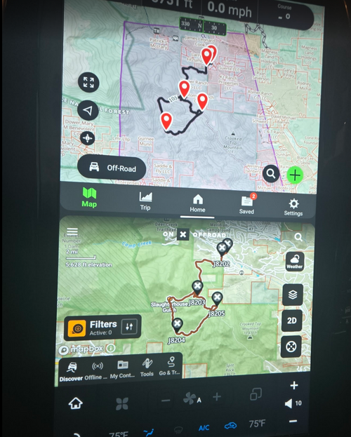
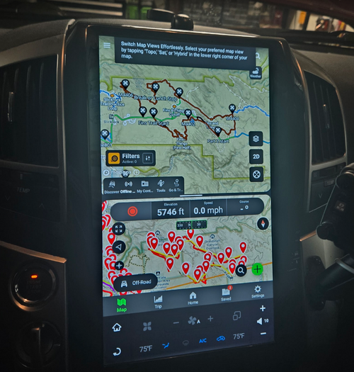
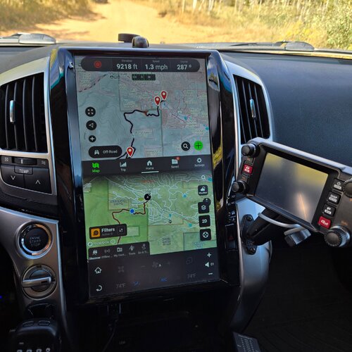
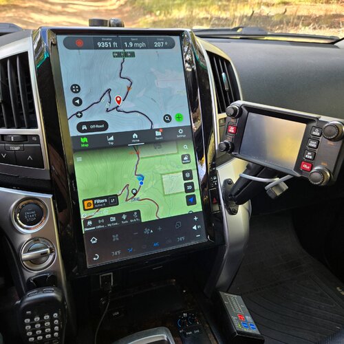
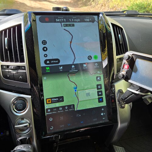
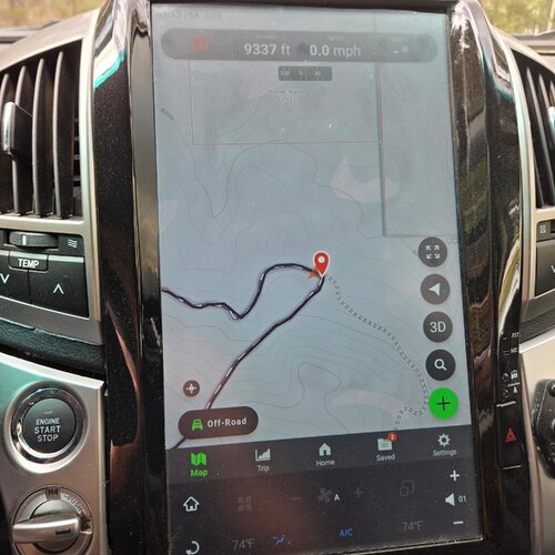
We ran Slaughterhouse today which gave me an opportunity to try out ONX off road and Gaia on the same screen

I loaded both with the same .gpx track

Both programs have had the topo layer loaded

Both running with the Android App on my headunit
20260916_102646.jpg

20260916_104007.jpg

Both did the job well. Gaia's record button is right there along with altitude and heading.

Onx you can record a trail via the GO&TRACK button on the right. I did not try it. Searching after I got home says I could have used that button for the altitude as well. I haven't verified that, has anyone else done that?

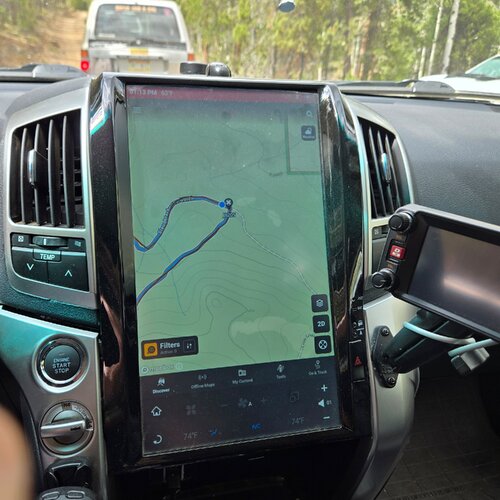
The color tone of the ONx screen is more of a green tone.

Both did a similar job of following the track. I could have navigated the trail with either app had I not been there before

OnX seems less busy as it will combine waypoints until you zoom in
20260916_103441.jpg

I then went full vs spilt screen for a bit on both. The side trail was a little easier to see in Gaia (based on color tone) but not much to the eye
20260916_131307.jpg

20260916_131324.jpg

I haven't done any editing, creating or anything more complicated. If you want to just load a track and follow it, either seem to do the job
 

Romer

Moderator
Staff member
Joined
Aug 22, 2005
Messages
10,791
Location
Centennial, Colorado
Onx you can record a trail via the GO&TRACK button on the right. I did not try it. Searching after I got home says I could have used that button for the altitude as well. I haven't verified that, has anyone else done that?
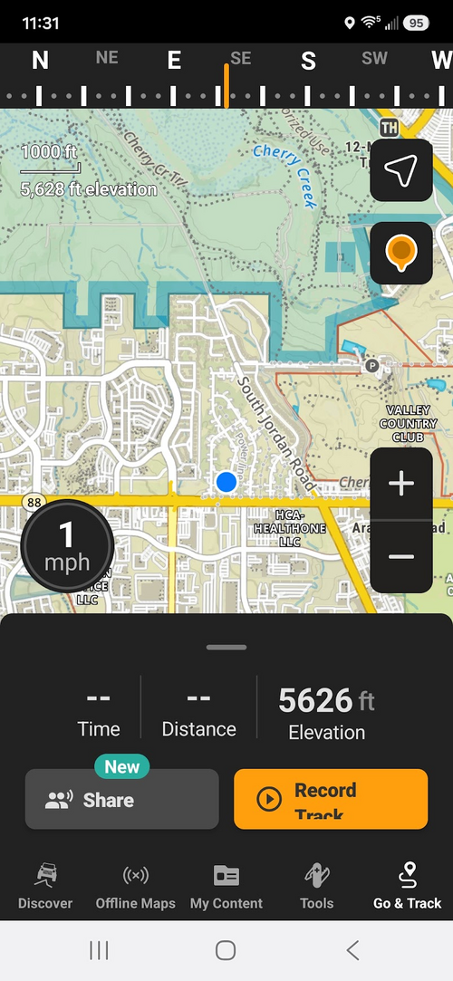
I was curious about this so I tried it on my Phone. It is running the same app as my 200 head unit.

press the GO&Track button and you get this window

It has the record button, altitude and compass heading

The caveat is I did this sitting in my office, but don't see why it wouldnt work while running a trail to see the altitude and compass heading

Anyone try this while on a trail?
1789753077933.png
 

nakman

Rising Sun Member
Staff member
Joined
Aug 23, 2005
Messages
15,720
Location
north side
Anyone try this while on a trail?
1789753077933.png
Yeah I use that button to start recording... and seeing the altitude for a second is cool I guess. but I really wish it were up top in a banner, like they have it in Gaia.. along with speed. Just seems like a miss to me, like when some of my toyotas give me actual psi for tires, while others just an idiot light for low pressure, but I know in both they have the data it's just that one is choosing not to show it. I know I have other ways of knowing how fast I'm going, and for that matter I can always measure tire pressure. still, a slightly better interface would be an improvement.
 
Back
Top