Vail, Camp Hale Area 7/22,23,24

nakman

Rising Sun Member
Staff member
Joined
Aug 23, 2005
Messages
15,201
Location
north side
Further north.. does that mean closer to Perry's waterfall? :perry:
 

SRT08BUS

Hard Core 4+
Joined
Jul 28, 2009
Messages
691
Location
Colorado
I'll be bowing out of this one as I will be going to the FJC Summit, but will be doing this next year (hopefully around the same time) for the start of my FJC Summit trip.....have fun!!!
 

bh4rnnr

Outlaw, Scoundrel, Miscreant
Joined
Aug 23, 2005
Messages
6,309
Location
Littleton

farnhamstj

Hard Core 4+
Joined
Aug 22, 2005
Messages
2,609
Location
vail co
Further away from the waterfall. But I will make an effort to bring a group there this year.
 

Jacket

Moderator
Staff member
Joined
Feb 3, 2006
Messages
5,405
Location
Lafayette
Looks like I'll have to miss this year as well. We'll be in Michigan that weekend.

Upon further review....my flight is supposed to land at 10:30 Saturday morning, so I think I'll try to roll on up Saturday afternoon in time for happy hour and some Sunday wheelin'. Just me though - the rest of my crew will still be on the lake.
 

DaveInDenver

Rising Sun Ham Guru
Joined
Jun 8, 2006
Messages
13,960
Location
Grand Junction
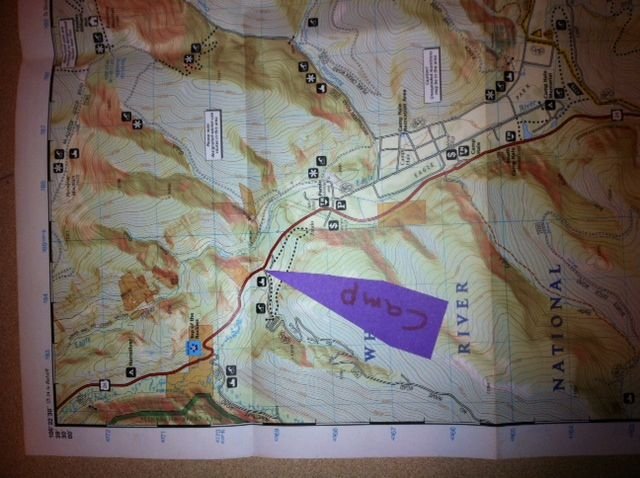
FWIW, we were up in the Camp Hale area this weekend.

Starting from the Pando TH, the whole length of Resolution Rd (FS702) to the FS751 junction was dry (very dry, very dusty). Large snow field a couple of hundred feet up FS702 beyond the junction prevents vehicles any further towards Ptarmigan Pass from south. Even the motorcycles were too sketched to try, the snow field is pretty long. This will have melted back enough for two-wheeled vehicles to start working by next weekend is my guess.

Continuing on Resolution Mt Rd (FS751), large snow field about 500 feet up the trail. Vehicle impassable at this point and is a few feet deep still. We were on MTBs and made it past on the thin snow at the S-SW edge. This is the highest point that previous hut users could drive, their vehicles (one a Subaru Outback) were parked here when we passed. This will prevent any motorized traffic for a while yet, at least a couple weeks before it's melted back that even the edge of the road will show through. Saw a couple of attempts at it, bumper deep ruts that are maybe half way to ground. There are no good winch points on the other side, so opening it will be shovels and many, many runs at it.

Another large snow field about 1/4 mile beyond, also would be impassable to vehicles. This one would have totally prevented any motorized traffic on Saturday but Monday had melted back enough that a motorcycle could conceivably sneak by on the road's edge for most of it. We walked over the middle, it is a few feet deep in the middle. I post holed two steps to my thigh with snow still underfoot. It is very wet with run-off under, so it'll start collapsing soon.

Came across nothing significant between the second snow field and the Fowler-Hilliard spur. One large snow field just beyond the junction at the snowmobile boundary (we shoveled an 18" wide path through the deepest part Sunday morning and it was down mostly down to muddy snow on Monday morning) and many small snow fields on the two-track leading to the hut and many muddy and soupy spots the whole way. It was mid 40s overnight and 70s during the day at the hut (11,500'). The fields near the hut melted back about a foot or two on the edges during the day Sunday, it was sunny and actually 'felt' hot during the day.

Almost zero snow found below 11,000', a handful of very small patches up to 11,250' only in very shaded spots. Large snow fields all were at or above 11,250'. There were plenty of them all over and lots of remaining snow fields around the hut. There was a group of ATV riders at the hut Saturday night, which came up from the north I think. Probably Wearyman Creek Rd (FS747). Also apparently the McAllister Gulch (jeep) trail was passable to ATVs, saw a few of them on top of Resolution Mt. From what we saw, far too many ATVs are driving around snow fields on the soft ground and, worse, the tundra. They are driving in some cases right over fallen "No Motorized Vehicles" signs. Literally, straddling them with tires on each side. Jackasses.

Another group at the hut this weekend hiked over from Shine Mt Inn via (mostly) the winter route over Ptarmigan Pass. They had snowshoes and sounded like they needed them about half the time during walk over. Took them about 7 hours via foot.
 

farnhamstj

Hard Core 4+
Joined
Aug 22, 2005
Messages
2,609
Location
vail co
Thanks for the update. I believe Shrine pass is still closed at this time. 705(wurts ditch) is almost passable, one drift about 30' long and 2' deep.
 

DaveInDenver

Rising Sun Ham Guru
Joined
Jun 8, 2006
Messages
13,960
Location
Grand Junction
Thanks for the update. I believe Shrine pass is still closed at this time. 705(wurts ditch) is almost passable, one drift about 30' long and 2' deep.
That was what I heard, but the hiking party said the gate was open but you meet a wall of snow not far up the road. They parked on Vail Pass someplace.
 

bh4rnnr

Outlaw, Scoundrel, Miscreant
Joined
Aug 23, 2005
Messages
6,309
Location
Littleton
Thanks for the update. I believe Shrine pass is still closed at this time. 705(wurts ditch) is almost passable, one drift about 30' long and 2' deep.

That was what I heard, but the hiking party said the gate was open but you meet a wall of snow not far up the road. They parked on Vail Pass someplace.

Was on Shrine yesterday. Crested the pass from Vail Pass. Didnt get all the way down. I turned around as I was annoyed with a dog owner letting his dog run the pass (cruising along in his vehicle) while he was a 100 or so yards in front of the tired dog.

Still a lot of snow up there but seems to be melting steadly. Have a feeling Shrine is going to be blooming in a few weeks.

Realy want to make the Camp Hale run, but need to keep focus on putting $ away for new tires/ alignment etc...


18.jpg


29.jpg


35.jpg


43.jpg


47.jpg


:beer:
 

nakman

Rising Sun Member
Staff member
Joined
Aug 23, 2005
Messages
15,201
Location
north side
Realy want to make the Camp Hale run, but need to keep focus on putting $ away for new tires/ alignment etc...


:beer:
Perry you're welcome to barnacle off of us for the weekend, send me a PM or email or something..
 

kurtnkegger

Rising Sun Member
Joined
Jan 24, 2011
Messages
1,545
Location
Denver Burbs
My Wife and I will be in Leadville that weekend. Thought we would drop over Tennessee Pass to Camp Hale for Saturdays run. Could you post the meeting time and place so we could join in??

Thanks,

Kurt
 

Jacket

Moderator
Staff member
Joined
Feb 3, 2006
Messages
5,405
Location
Lafayette
Are you thinking similar routes to last year, or are there new trails in the forecast? I think we did McCallister and Wearymans on Saturday, and a quick loop through Lime Creek on Sunday.

I might not make it up until later on Saturday, so I'd like to do something fun on Sunday if others are interested and extend that day a bit.
 

nakman

Rising Sun Member
Staff member
Joined
Aug 23, 2005
Messages
15,201
Location
north side
I'm up for whatever on Sunday, keeping in mind I'll be pulling a camper and maybe an extra kid.. but I'll go with the flow. I thought McCallister and Wearymans were awesome last year so would do those again on Saturday, or something else, whatever..

and despite what you may have read in Toyota Trails, I am not the leader here.. Farnham's the man! :bowdown:


Perry. :rant:

:) :lmao:
 

bh4rnnr

Outlaw, Scoundrel, Miscreant
Joined
Aug 23, 2005
Messages
6,309
Location
Littleton

farnhamstj

Hard Core 4+
Joined
Aug 22, 2005
Messages
2,609
Location
vail co
No worries, I like to fly below the radar anyway. Campsite Location has become Wurtz ditch rd #705. formally No Name rd. It is about a mile North of Camp hale on Hwy 24. South of Minturn. Road is on the rt.(west) Turn off pavement. Drive 1/4 mile. Camp on the left (south) side of road. This is dispursed camping and there are no facilities. Please plan accordingly. Nearest gas is Minturn, aproximatly 14 miles away, but a slow 14 miles. I have spoken to the Forest Service and everything we ran last year is still open, but there is snow and possible down trees. Bring Shovels and chainsaw. I'm confidant in our ability to get through. I'll scout them next week and give you a better report as I know more. I'll also post up better directions to camp with pictures.

Friday night: Italian Pot luck
Saturday night: Meat and Bacon Potluck
 
Last edited:

farnhamstj

Hard Core 4+
Joined
Aug 22, 2005
Messages
2,609
Location
vail co
39*27'50" 106*20'15"
 

Attachments

  • photo.JPG
    photo.JPG
    59.8 KB · Views: 300

Inukshuk

Rising Sun Member
Joined
Aug 24, 2005
Messages
8,054
Location
Denver, CO
39*27'50" 106*20'15"

Can you put that into the Google maps format? (find it on Earth, right click directions to here and it will give you the numbers)
 
Back
Top