Trail Run Planning Dinosaur Ntnl Mnmt Area - Sept 18-21, 2026 - Cool Cruiser Truck Club Camping Collab Continued - Please read first post

DaveInDenver

Rising Sun Ham Guru
Joined
Jun 8, 2006
Messages
14,344
Location
Grand Junction
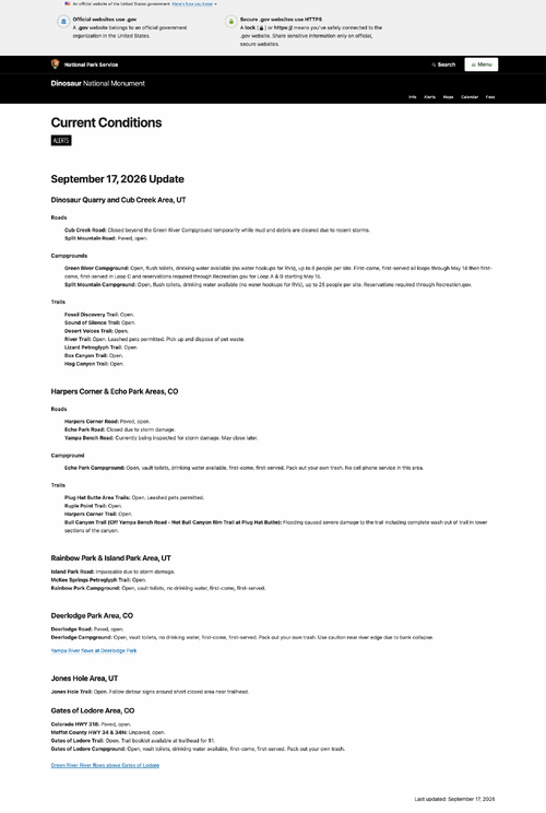
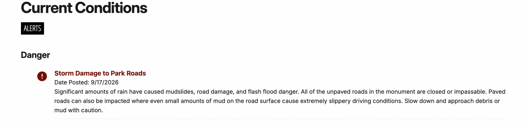
FWIW, we've gotten quite a bit of rain on the western slope this week and it's supposed to rain some today and maybe tomorrow. Just keep flexible on mud. I've been on the road into Echo Park during rain. Calling it road under those conditions is a stretch. It's a ribbon of snot.

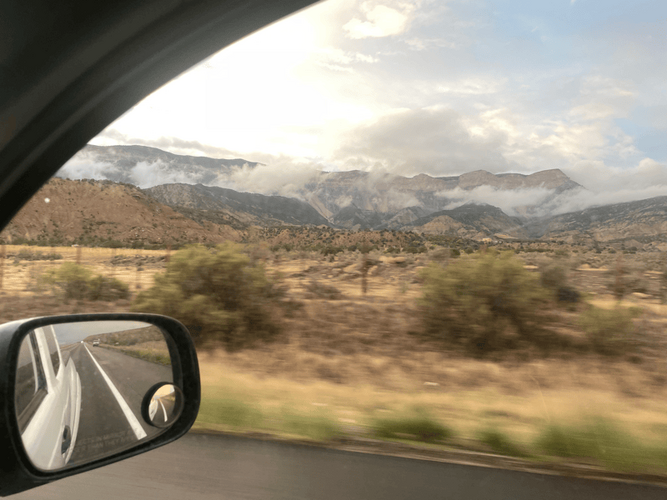
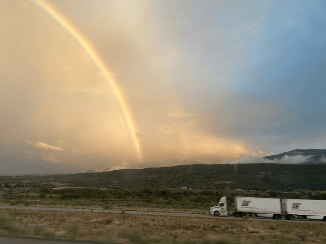
On the upside.

Roan Plateau and ...

IMG_5547_mid.png

... Battlement Mesa

IMG_5561_mid.png
 
Last edited:

allen.wrench

Rising Sun Member
Joined
Dec 7, 2018
Messages
865
Location
Syracuse, UT
Thanks for the check on fire restrictions Dave. Matt, @90WT, who were you able to talk with and have them say Solo stoves are allowed? NPS or BLM?

Allen
 

DaveInDenver

Rising Sun Ham Guru
Joined
Jun 8, 2006
Messages
14,344
Location
Grand Junction
I called the Dinosaur National Monument info line and talked with a Ranger who approved solo stoves: 435-781-7700
@allen.wrench this is easy to believe. I'd have asked for a Ranger's name personally since it's not to my knowledge a blanket rule at the Federal level but many counties, Garfield does I know, allow a commercial fire pit during stage one. The Garfield sheriff does say store-bought, not a portable fire pan and/or rock ring though but a Solo would I think easily meet this criteria.

FWIW: https://www.garfieldcountyco.gov/emergency-management/

The one hitch is the Feds may still only allow wood fires in developed campgrounds even in a Solo, not at-large or dispersed.
 
Last edited:

DaveInDenver

Rising Sun Ham Guru
Joined
Jun 8, 2006
Messages
14,344
Location
Grand Junction
Ah yes. Good point. She said in Dino NP, fires are only allowed in the developed campgrounds, solo stoves would be allowed there. No disbursed camping allowed in Dino NP.
Truth on DNM. I spoke inexactly and meant broadly since the book end night(s) Allen usually has you guys dispersed and the BLM/USFS/NPS might respect a county-level exception for them elsewhere.
 

allen.wrench

Rising Sun Member
Joined
Dec 7, 2018
Messages
865
Location
Syracuse, UT
Hey so just saying, I hear all the rain is making the grass super green, and new plants are growing. It’s nuts, no pun intended. Nuts grow on trees. Surprised there is a burn ban at all. We will be cognizant and respectful of all restrictions in place. The planned route is just a plan. What we drive is open to adjustment as necessary.

Another plus of all the weather is there should be very few tourists and very little dust. If we can't do real offroadin, we can happily chill in the managed NPS campgrounds and enjoy the park like that. At worst we'll head home a little early and have time for laundry. Thanks Mother Nature! :D Dinosaur Monument sucks, tell your friends ;)

Allen
 

timmbuck2

Land Use Coordinator
Staff member
Cruise Moab Committee
Joined
Oct 5, 2005
Messages
6,095
Location
Denver

marcus clarkus

New-ish
Joined
Nov 26, 2025
Messages
16
Crazy hail storm in Dinosaur right as I rolled up! I’m shocked that my LC isn’t covered in dents.

I got an emergency alert for a flash flood warning so I might wait out for the storm to fully pass before leaving pavement
 

allen.wrench

Rising Sun Member
Joined
Dec 7, 2018
Messages
865
Location
Syracuse, UT
Be aware folks, I heard news from Rob that Blue Mountain Road is a little muddy.

I recommend taking paved Harper's Corner Road to the top of the ridge line before taking the dirt BLM road to Stuntz Ridge and our first campsite "Cow Pie Basin".

Allen
 

DaveInDenver

Rising Sun Ham Guru
Joined
Jun 8, 2006
Messages
14,344
Location
Grand Junction
Crazy hail storm in Dinosaur right as I rolled up! I’m shocked that my LC isn’t covered in dents.

I got an emergency alert for a flash flood warning so I might wait out for the storm to fully pass before leaving pavement
Yeah guys, our weather radios here in GJ alerted about 4:50PM to golf ball and ping pong ball sized hail in Garfield, Moffat and Rio Blanco counties.

The flash flood warning is in effect until 745 PM MDT.

Screenshot 2026-09-18 at 17.15.44.png
 
Last edited:

DaveInDenver

Rising Sun Ham Guru
Joined
Jun 8, 2006
Messages
14,344
Location
Grand Junction
Code:
Flash Flood Warning
COC081-103-UTC047-190145-
/O.NEW.KGJT.FF.W.0125.260918T2252Z-260919T0145Z/
/00000.0.ER.000000T0000Z.000000T0000Z.000000T0000Z.OO/

BULLETIN - EAS ACTIVATION REQUESTED
Flash Flood Warning
National Weather Service Grand Junction CO
452 PM MDT Fri Sep 18 2026

The National Weather Service in Grand Junction has issued a

* Flash Flood Warning for...
  Southwestern Moffat County in northwestern Colorado...
  Western Rio Blanco County in northwestern Colorado...
  East Central Uintah County in northeastern Utah...

* Until 745 PM MDT.

* At 452 PM MDT, Doppler radar indicated thunderstorms producing
  heavy rain across the warned area. Flash flooding is ongoing or
  expected to begin shortly.

  HAZARD...Flash flooding. Thunderstorms producing flash flooding.

  SOURCE...Radar indicated.

  IMPACT...Flash flooding of creeks and streams, urban areas,
           highways, and streets.

* Some locations that will experience flash flooding include...
  Dinosaur, Artesia and Blue Mountain.

PRECAUTIONARY/PREPAREDNESS ACTIONS...

Turn around, don`t drown when encountering flooded roads. Most flood
deaths occur in vehicles.

&&

LAT...LON 4014 10905 4010 10913 3999 10939 3990 10962
      3993 10969 4001 10970 4013 10954 4023 10937
      4031 10924 4039 10899 4037 10886 4024 10885
      4017 10897

FLASH FLOOD...RADAR INDICATED
FLASH FLOOD DAMAGE THREAT...CONSIDERABLE

$$

KS

Code:
Severe Thunderstorm Warning
COC081-103-UTC047-182345-
/O.NEW.KGJT.SV.W.0038.260918T2315Z-260918T2345Z/

BULLETIN - IMMEDIATE BROADCAST REQUESTED
Severe Thunderstorm Warning
National Weather Service Grand Junction CO
515 PM MDT Fri Sep 18 2026

The National Weather Service in Grand Junction has issued a

* Severe Thunderstorm Warning for...
  Southwestern Moffat County in northwestern Colorado...
  Northwestern Rio Blanco County in northwestern Colorado...
  Northeastern Uintah County in northeastern Utah...

* Until 545 PM MDT.

* At 514 PM MDT, a severe thunderstorm was located over Dinosaur, or
  29 miles southeast of Vernal, moving northeast at 30 mph.

  HAZARD...Quarter size hail.

  SOURCE...Radar indicated.

  IMPACT...Damage to vehicles is expected.

* Locations impacted include...
  Dinosaur, Artesia, and Blue Mountain.

PRECAUTIONARY/PREPAREDNESS ACTIONS...

For your protection move to an interior room on the lowest floor of a
building.

&&

LAT...LON 4019 10901 4033 10912 4056 10883 4032 10860
TIME...MOT...LOC 2314Z 237DEG 24KT 4028 10902

HAIL THREAT...RADAR INDICATED
MAX HAIL SIZE...1.00 IN
WIND THREAT...RADAR INDICATED
MAX WIND GUST...<50 MPH

$$

BS
 

DaveInDenver

Rising Sun Ham Guru
Joined
Jun 8, 2006
Messages
14,344
Location
Grand Junction
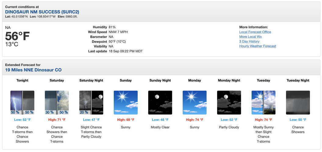
Screenshot 2026-09-18 at 21.48.54.png

Code:
614
FXUS65 KGJT 182331
AFDGJT

Area Forecast Discussion
National Weather Service Grand Junction CO
531 PM MDT Fri Sep 18 2026

.KEY MESSAGES...

- Scattered storms will develop this afternoon with stronger
  storms capable of producing strong outflow winds, small hail,
  and localized heavy rainfall.

- The threat for localized flash flooding will be heightened
  today due to saturated soils and the potential for additional
  heavy rainfall.

- After decreasing precipitation chances this weekend, another
  push of monsoonal moisture arrives by Tuesday.

&&

.DISCUSSION...
Issued at 1152 AM MDT Fri Sep 18 2026

ONE LAST RAINY DAY; DRYING OUT THIS WEEKEND:

A low pressure system will track across the Intermountain west
over the next 24 hours which will break us out of the ongoing
wet pattern. Until then, expect one last day of scattered to
widespread showers and storms. Northeast Utah and northwest
Colorado in particular could be the hot spot for stronger storms
with stronger wind shear and instability expected. Isolated
strong storms cannot be ruled out elsewhere. With stronger
daytime heating expected today, storms will be capable of
producing strong outflow winds, hail, and heavy rainfall. The
threat for localized flash flooding will be heightened due to
antecedent saturated soils and the potential for additional
heavy rainfall.

By Saturday, the passage of a cold front will help scour some
of the moisture from the region, but PWATs will remain around
150% percent of normal. This means that the storm coverage and
the threat for heavy rainfall will decrease, but enough moisture
remains in place to support isolated to scattered convection.
Sunday looks drier yet with PWATs 75-125% of normal. However, we
expect enough remnant moisture for isolated convection over the
higher terrain.

MORE MONSOON NEXT WEEK:

The relatively dry period won`t stick around for long as
moisture- rich southwesterly flow kicks back in Monday PM into
Tuesday. While the details could fluctuate between now and then
with variance amongst and within ensemble families, the general
thought is that wetter weather will return by Tuesday and could
remain in place throughout the week. Early guidance supports
wetter weather, especially south of I-70, but less widespread
than we`ve experienced this week.

 
Back
Top