5th Annual Ghost Town Run

Joined
Mar 25, 2006
Messages
32
Location
Westminster, CO
More photos:
http://www.flickr.com/photos/cougar337/sets/72157621750753327/

DSCN1253.jpg

DSCN1277.jpg


Everyone at the gate near the Alpine Tunnel
DSCN1290.jpg

DSCN1292.jpg


DSCN1302.jpg


Cheeseman at Mirror lake about to start up Tin Cup Pass
DSCN1305.jpg


Tin Cup is a bumpy ride!
DSCN1315.jpg


Treeroot and Cheeseman at the top of Tin Cup pass
DSCN1327.jpg


Mike working on the missing/broke studs
DSCN1362.jpg

DSCN1364.jpg

DSCN1367.jpg


Much more photos:
http://www.flickr.com/photos/cougar337/sets/72157621750753327/
 

JadeRunner

Rising Sun Member
Joined
Aug 23, 2005
Messages
1,836
Location
Lakewood, CO
Thanks for the pics Jeff, you know like the say it never looks that bad in the picture, always feels worse in real life. Anyway that last one was the first setup.. where we got it secured enough to think about our next move. The second revision involved swapping your strap with a short treesaver, and swapping the strap on the FJ out with my winch cable. With you keeping the back end in check, several guys on a strap on the B pillar, I had the security I needed to drive/winch the front end back up off of the FJ- truck, get everyone safe, but unless the world is about to end think for a minute and come up with a good plan. We really did a good job at this and I'm glad it happened in a manner that everyone involved could learn something, I know I did and always do.

I know what you mean that the pics don't do it justice. It reminds me of snow runs when people were teetering on the side of a self road. A short winch of the engine directly up onto the road is the trick. Securing the rear was a nice bonus for you guys, way to go. I was glad to hear your wife and family weren't freaked out. It's a bad feeling that could change your opinion about wheeling.

I still don't understand how Treeroot's built 80 had those issues. It just doesn't make sense.
 

subzali

Hard Core 4+
Joined
Aug 22, 2005
Messages
10,638
Location
Denver CO
one of the things I love about Mike and I can never figure out is that no matter what seems to be happening he's got a big grin on his face and usually laughing as well. Even when his own truck is broke.
 

Caribou Sandstorm

Hard Core 4+
Joined
Mar 1, 2008
Messages
3,152
Location
Denver
We had a great time also! Thanks for having us! Perry we love the poster and it is already at the framers getting a "Barn Wood" frame. Going up in my office ASAP! Thank you! A few more pics...

606114307_9kksG-M.jpg


606120529_GziW3-M.jpg


606114580_sUk4f-M.jpg


606120282_UjMT5-M.jpg


606114822_mgHpn-M.jpg
 

Jethro

0
Joined
Sep 1, 2005
Messages
68
More Pics

My daughter, Kerry put her pictures up here. We had a lot of fun. This is always a great run. Special thanks to Groucho. Hope you got your nose cleaned out.
 

Groucho

Rising Sun Ham Guru
Joined
Aug 22, 2005
Messages
1,699
Location
Brighton, Colorado
Trip report Pt 1 (finally!)

OK, so I guess it is about time I get the trip report done. Here goes.

Thursday morning we loaded up the family in the 80 with our popup in tow and headed out for Pitkin and the campsite. We decided to take Thursday to head out to ensure that the campsite was available to our large group and to relax as a family before the event started.

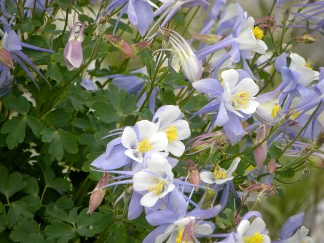
After being very nervous that the campsite would be open, we arrived there about 4pm to find that three 5th wheel campers were already in part of the campsite. Regardless, we took the same spot we occupied last year and set up camp. The stream that ran 30 feet from our popup was beautiful, and the kids and Andrea and I had a fun time splashing around in the warm afternoon mountain air and cold mountain stream. After realizing Thursday night that we had forgotten the marshmallows at home, we decided to take a quick trip into Gunnison to get some, along with a hummingbird feeder and a couple other necessities. The campsite had several hummingbirds, and we thought the kids might enjoy watching them feed, which they did.

Shortly after our early afternoon return to the campsite, and while splashing in the stream again, Cheeseman and Jill and the Nakman family arrived at the campsite. We helped Tim and Michelle set up their popup and listened to the stories about the chatter on the 146.460 from many of the vehicles somewhere on the road to the campsite that afternoon. Pretty soon it was like a bees nest in the evening, with everyone setting up camp and getting ready to have a barleypop (or drink of their choice).

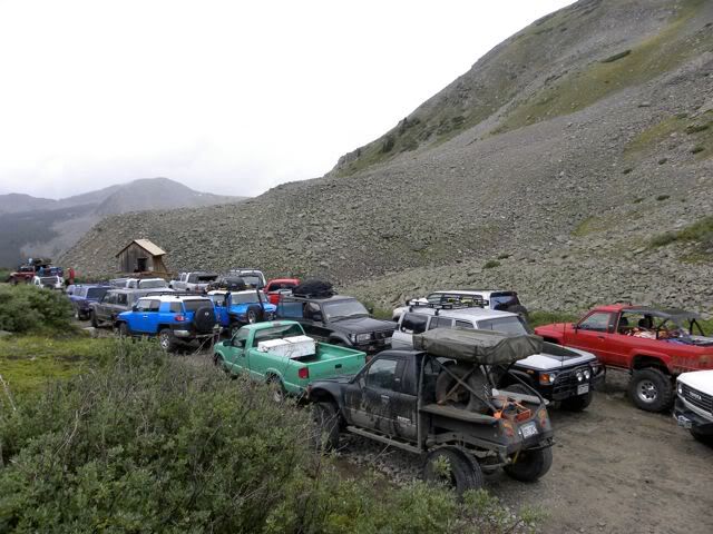
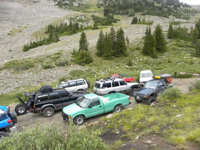
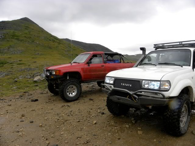
Initially the group could have been 30 rigs total, if everyone who had previously said they were going actually showed up. After our quick count at the top of Hancock pass we had 23 rigs in attendance, and if we included Neil Quigley, we met the record of 24.

On Saturday morning, we did what may be called a tradition on the GTR, we had to get up uber early (for a vacation) to head over Hancock pass to meet the group from Denver in St Elmo. We made fairly good time in awesome weather (about 50°F all the way) with nar a cloud in the sky and arrived just ahead of the Denver group by 10 minutes. Since the highlights of St Elmo included the ghosts in town, the wooden sidewalk, the hummingbirds and feeding the chipmunks, everyone soon walked from our large gathering of vehicles to hit their favorite activity. We had lots of fun feeding the chipmunks, and some people mentioned that it was the first time they had actually seen them storing nuts in their cheeks. It was amazing, you could actually see the cheeks getting fatter until they went away to put them in storage.

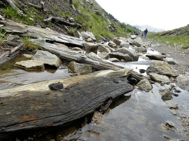
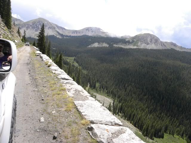
After our visit to St Elmo, we got everyone together to start the ascent of Hancock pass, where we would meet about 12 trucks consisting of the campers who weren’t ready to get up uber early. We headed up the railroad grade, passed the oldest auto bridge in Colorado not still in use, past the Mary Murphy Mine (which had been a stop on previous GTR in this region), under the leaning mine building and on through the town site of Hancock. After Hancock, the road became more of our flavor, with more of a 4WD feel to them. We met up with the late group at Hancock pass at about 11:30, and after a brief stay at the summit, we headed down toward Tomichi Pass.

The way down Hancock to the intersection of Hancock and Tomichi was quick, with the exception of a traffic jam at the only 3 point turn on the trip. After that it seemed to be smooth sailing upwards toward Tomichi, until (albeit late) we learned that the Nakman family was clinging precariously to the loose edge of the shelf road along the east side of Tomichi pass. With that, I asked Cheeseman to make his way to the rescue location (we were already at the summit of the pass) where he could be the point man if need be, while I guided the rest of the flock not directly engaged in rescue matters who were ahead of Tim’s 80 to follow me down the pass to the lunch spot.

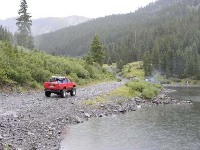
After a slow go down, we finally picked a wide spot in the road a gingerly parked out of the way to eat lunch while we waited anxiously to hear about the recue mission. We heard that Tim was back on terra-firma and was on his way down shortly after we stopped. When we had all had our fill of watermelon, the trip started up in earnest again, this time headed for Black Sage and Waunita passes. The roads toward these passes are paved gravel, so speed was quick. After cresting Black Sage pass, and knowing that there was a shortcut to the campsite that did not go through Pitkin, I asked Subzali if he was up for a challenge. He accepted, and soon was joined by about 5-7 rigs who were going to try and weave their way along Middle Quartz Trail to the campsite. Thr group split up, and we remained in contact until just before the main group got to Pitkin, about 4PM.

After a brief stop in Pitkin to fuel up and see the general store, we all made our way to the campsite to start cooking for the potluck. It was at this time we heard faintly on the 2M that the Middle Quartz group was lost, but willing to find their way or go back to trace our path over Waunita if need be. So we continued cooking, even through the rain that came down for about an hour.

Shortly after the rain stopped, the 2nd group started to arrive just as appetizers were ebing consumed in mass quantities. Everyone was safe and beginning their feast. We had everything from Brie and guacamole, to ribs and cherry cobbler and sushi. We had more food than we could consume and a great time was had by all (and their stomachs). Thankfully no one got sick this year.
 

Groucho

Rising Sun Ham Guru
Joined
Aug 22, 2005
Messages
1,699
Location
Brighton, Colorado
Trip Report pt2

Sunday morning started with everyone leisurely taking camp down, and three groups heading out. One group left for the Alpine Tunnel right at 10AM, followed by a second group at 10:20. A third group decided to go over Cumberland Pass and not go to the Alpine Tunnel. While getting our history lesson on the way up to the tunnel, we passed the water tanks, Woodstock (home to the avalanche that killed 13, including the boarding house owners 6 children), Sherrod loop and the palisades. These are all marvels of the area, and were wonderful to take pictures of and pass. But the best was yet to come. The Alpine Station is a greatly restored area (most of it anyway) preserved for future generations to learn about the hardships, challenges and achievements of those who came before us to open up this great country of ours.

After getting our history fill, and the start of a brisk rain, we all headed out in our own directions. Some folks took Hancock back toward Buena Vista and home, others went over Cumberland and others went back to Pitkin and over Monarch pass to home. All in all we ended up about reaching our destination all within an hour of each other.

I hope that everyone enjoyed the trip as we did, and my family would like to thank everyone for coming along our little tour of history. See you all again next year!!
 
Joined
Mar 25, 2006
Messages
32
Location
Westminster, CO
My daughter, Kerry put her pictures up here. We had a lot of fun. This is always a great run. Special thanks to Groucho. Hope you got your nose cleaned out.

What beautiful pictures you must tell her for me. I really like her style of photo taking and the website as a whole is very nice. We tried using Simpleviewer once and it was a little bit of a pain for us to update photos but it sure looks cool!
 
Joined
Mar 25, 2006
Messages
32
Location
Westminster, CO
Trip report pt 1
Trip report pt 2

Nice report Nathaniel!!! There was so much going on it was hard to keep track, very detailed here. Thanks again for such an awesome trip and the history behind what we saw and where we were, I really enjoyed that!!
 

subzali

Hard Core 4+
Joined
Aug 22, 2005
Messages
10,638
Location
Denver CO
To add a little bit to the "other" group taking the "shortcut" to Middle Quartz:

The trip was going well for the better part of an hour. I wouldn't call this route a shortcut, but I would call it a scenic route. It was going up through a safari-like grassy fields and meadows, up through some trees with some babbling brooks, and was just pretty in general. We were following the maps and GPS fine but we got to a point where loggers had altered/created trails and carsonite was missing at some intersections. The area didn't quite match what my map (National Geographic) showed as far as trail intersections were concerned, and the GPS wasn't helping very much either. So we decided to try and take the left fork, which should have circumvented the knob of the hill we were trying to go over and then zigzag back down the other side to the Middle Quartz campground. Well it didn't. It took us WAY left and ended up pointing us back down towards the valley from whence we had come. Finally we got to an intersection that was numbered, but I couldn't find the numbers on my map. Tim Nakari pulled out his Gazetteer and when we looked at the trails (at a much smaller scale than I would normally try to navigate by) we thought we were at such-and-such an intersection that would take us down to our desination. We started that way and came to another intersection that again had poor signage. We went left and down and ended up at a closed gate :mad:. Before we had a chance to turn around, an ATV came up from the other side of the gate and we discussed briefly where he thought he was and compared it to where we thought we were. We were still on the east side of Waunita Pass, it was discovered, and so we had to go back up to the last intersection where we had gone left, as we should have continued straight instead of turning. After a few minutes of going through the woods we came out at Waunita Pass and continued down to Pitkin.

I felt bad about the whole thing for a couple reasons:
1. I was the "leader" of the group and ended up getting us lost. I wasn't diligent with my mapping skills and didn't completely adhere to the rules you are supposed to use when navigating with a map. I think there were times I was trying to fit the terrain to where I thought I was on the map rather than let the terrain tell me where I was on the map. I also didn't use a compass like I should have to orient myself and make sure we were travelling in the right direction.
2. I also didn't have a complete map of the area; the trail we were supposed to go on was JUST on the edge of the map I had and by the time we got lost we were off of my maps so I was useless.
3. I didn't want to trust the GPS units in some of the other vehicles; because we were pretty far off of a paved road I didn't think the GPS had any idea where we were. I still think the GPS units were wrong in a couple instances, but I should have been more willing to stop and try to match what they were saying up with what the map said so that we could use two tools instead of one.

So I apologize to those who were there and had to put up with me and my stubbornness and then ended up bailing us out of the situation. While it wasn't critical at any point (we weren't low on fuel, have an injured person with us, low on food, we knew how to go back the way we came etc.) it was a wake-up call to me that it's been a few years since boy scouts and I haven't been keeping in good practice with orienteering and I need to brush up on it some more. That and maybe get a GPS unit (which I've been wanting to do anyway), learn how it works, and learn how to use it in parallel with the maps.
 

rover67

Rising Sun Member
Joined
Nov 1, 2007
Messages
9,582
Location
Boulder, Co
Hey Matt, I think we all went into it knowing what we were getting into. It was an adventure.. that's what it was supposed to be :)
 

corsair23

Hard Core 4+
Joined
Jul 11, 2006
Messages
8,610
Location
Littleton
Hey Matt, I think we all went into it knowing what we were getting into. It was an adventure.. that's what it was supposed to be :)

x2 - The scenery was amazing and well worth the detour :D...Next year we'll have to try going to the right at the logging area and see where that takes us.

Personally it was a lot of fun for me because that is how I use to "wheel" in the old days....Just drive until I found a side road and head off on it to see where it took me :thumb:

Although next year I think I'll bring some trimming shears or something to cut back the growth...The new pinstriping doesn't look so great on a Lexus :lmao:
 

nakman

Rising Sun Member
Staff member
Joined
Aug 23, 2005
Messages
15,201
Location
north side
Yeah same here, I thought the adventure was a lot of fun- we always run trails where we know where we're going, it's fun to get a little lost every now and again and have to figure your way out of it-

I think next time we should just go right instead of left way at the start of the trail.. the first decision we made. Would have put us right of that whole logging mess altogether and closer to Middle Quartz instead of back towards Waunita pass.
 

ttubb

0
Joined
Aug 5, 2007
Messages
610
Location
Crested Butte/Tucson
It was a blast!

x4 - I had a great time, got to spend more time talking to Perry and saw some great country. You certainly do not need to apologize! :thumb: :thumb: :thumb: :thumb:
 

bh4rnnr

Outlaw, Scoundrel, Miscreant
Joined
Aug 23, 2005
Messages
6,300
Location
Littleton
Matt, like others have said, dont stress. It was a great adventure and I can now cross of the list of coming to one of those gates you can get to from either end.

To be honest, i'm starting to think we made a wrong right (should have gone left at one of those intersections) hand turn higher up, but who am I kidding, last time I was on this trail it was 2am and I was riding passanger for Neil.

The trail was awesome, company spectacular, and just a grand ol time. And by the time we got to camp, the food was cookin:bowdown:
 
Back
Top