FYI, just so people are clear this is the forest management plan, not just travel or motorized. So it's going to affect
a lot of stuff. And it's generalized management direction. Do they target resources (lumber, grazing), human-powered recreation, OHVs? What archeological and geological features, flora and fauna are being protected? What chunks of land get set aside, what is left open or managed differently, what are summer vs winter use priorities?
We just got 32 new miles of singletrack from the Mesa top to Palisade done this year and Silverton Singletrack Society has just started working on a bunch of new trails. I don't want to stop the momentum regarding bikes that we have with local USFS offices.
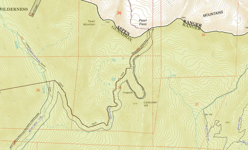
So I was waiting for the GIS data to come online to dig into details but suffice to say as of right now my main concern isn't protecting OHVs. The draft appears is recommending new Wilderness and special management areas, for example, so preventing more loss of access (specifically mountain bikes for me but generally) is critical.
There's statements in the document that bother me that seem to be putting the cart before the horse. There's lengths of the Tabegauche Trail (for example south of Bangs Canyon) that are going to fit the pre-existing criteria and I've thought in danger of de-facto Wilderness-ization, being consumed because they are cherry stemmed.
Standards
MA-STND-RECWLD-02: Recommended wilderness shall be managed consistently with the adjacent designated Wilderness. Pre-existing non-conforming uses may continue so long as they do not impair the area’s wilderness characteristics.
Objectives
MA-OBJ-RECWLD-03: Within 5 years of plan approval, physically close all unauthorized routes within recommended wilderness and take actions that promote restoration along such routes.
Realize that the OHV situation is real out here so the threat of closing access completely exists in places. The risk seems to be splintering user groups to eventually push out all users. And it's a tough one, the OHVs are really pissing me off lately and I'm on their side generally. There's been jerks from other user groups (MTBs, nor indeed hikers even, are
certainly not immune) but the biggest problem is SxS without a doubt and their actions tend to undermine snowmobile, 4WD and dirt bikes users.